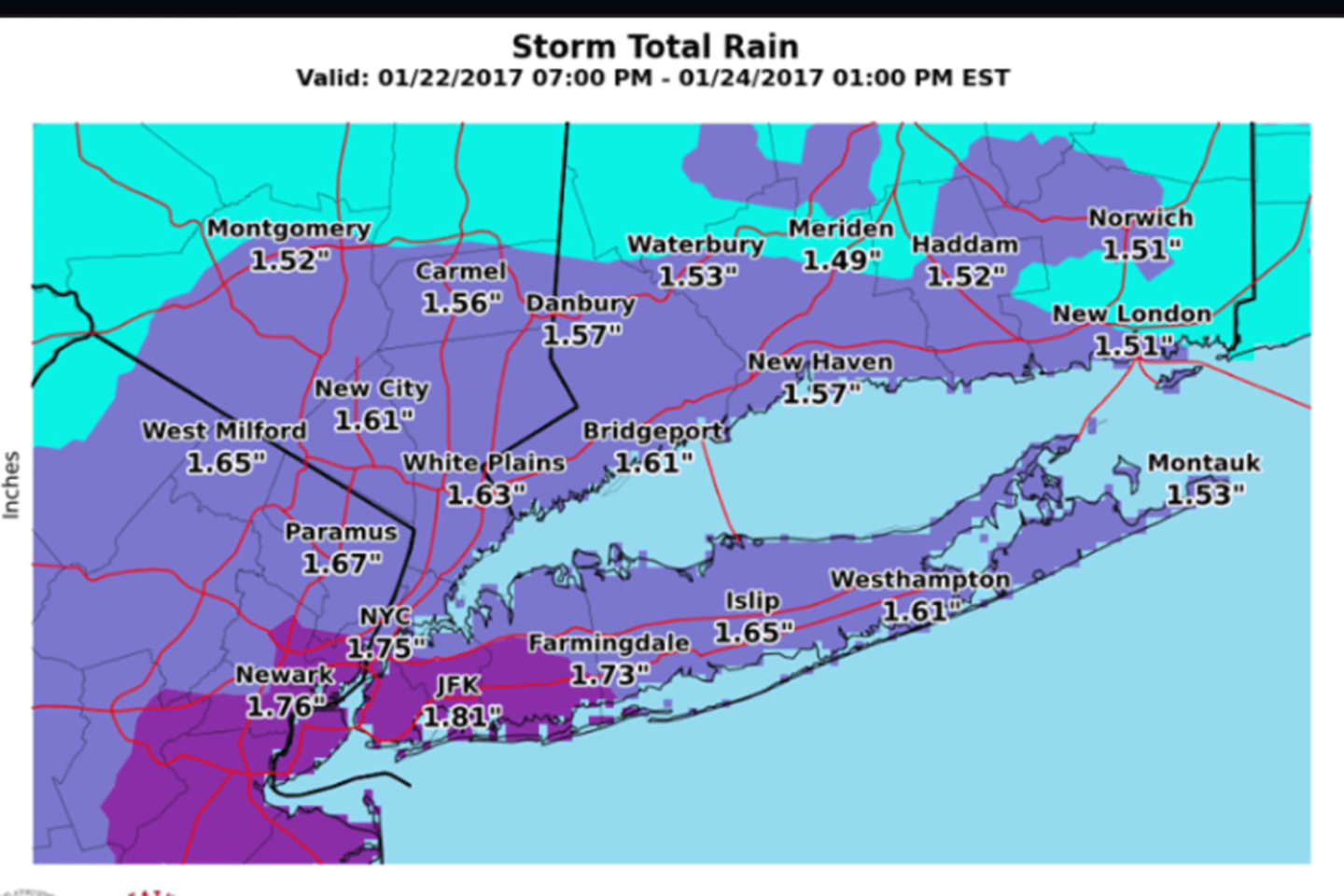
Anywhere from 1.5 inches to close to 2 inches of rain is forecast during that time period. There will likely be locally higher amounts, according to the National Weather Service.
The bulk of the rain is currently forecast to fall during the day Monday and into the first half of Monday night.
A High Wind Watch that includes Southern Westchester is in effect from 1 a.m. Monday to 1 a.m. Tuesday. Winds of 30 to 40 miles per hour with gusts up to 60 mph are likely during that 24-hour period.
Downed trees and power lines are likely with numerous power outages possible, according to the National Weather Service. Travel could be difficult, especially on elevated roads and bridges, the weather service warns.
The potential exists for locally moderate coastal flooding during Monday's evening high tides.
There is a chance of rain starting in the afternoon Sunday, which will be an unseasonably warm day with a high around 50.
Rain becomes likely overnight Sunday into Monday, when steady rain is likely during the day and evening. Tuesday's high temperature will be in the low 40s.
Rain is likely to continue through around 8 a.m. Tuesday. The rest of the day Tuesday will be mostly cloudy with a high in the mid 30s.
Check back to Daily Voice for updates.
Click here to follow Daily Voice Lewisboro and receive free news updates.